


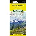

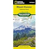


I always purchase maps from this series for planning purposes. You can typically see the entire park with all features on one map. It is not a super detailed topo, but it gives you a great overview of the terrain and the trails. It is also highly water resistant.
I have about twenty of these maps, typically for the western United States. I use them with my hiking friends prior to embarking. For areas requiring extreme detail, I purchase USGS a topo map (generally available at the park). Nonetheless, Trails Illustrated maps are excellent maps and reveal a lot of information that you need before the hike.
Enjoy fast, free delivery, exclusive deals, and award-winning movies & TV shows with Prime
Try Prime
and start saving today with fast, free delivery
Download the free Kindle app and start reading Kindle books instantly on your smartphone, tablet, or computer - no Kindle device required.
Read instantly on your browser with Kindle for Web.
Using your mobile phone camera - scan the code below and download the Kindle app.


Frequently bought together

$14.94
Get it as soon as Friday, May 17
In Stock
Total price:
To see our price, add these items to your cart.
Choose items to buy together.
Similar items that may deliver to you quickly
Page 1 of 1 Start overPage 1 of 1
From the Publisher
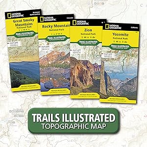
National Geographic Trail Maps – An essential tool for exploring America’s top National Parks
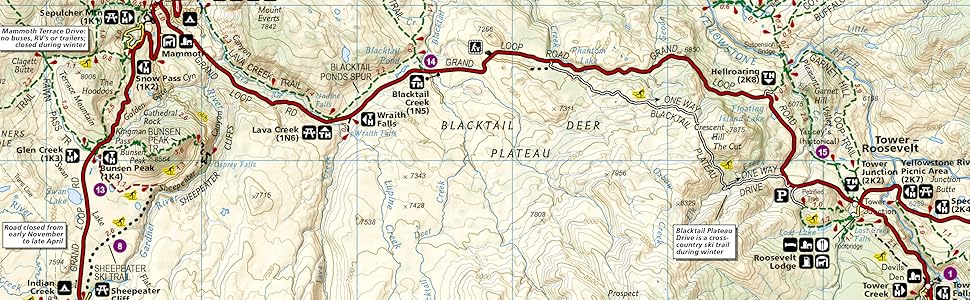
National Geographic’s line of Trails Illustrated maps includes detailed topographic trail maps for all of America’s top National Parks. Featuring updated and easy-to-read trail networks, important points of interest, and the key recreation information needed to make your next National Park visit an adventure.
National Geographic and the National Parks share a deep legacy dating back to the publication of an entire issue of National Geographic Magazine in 1916 titled 'Land of the Best'. That issue helped advocate for the creation of the National Park Service, later that year. Over the years, National Geographic has helped establish, preserve, or restore Sequoia, Katmai, Carlsbad Caverns, Shenandoah, Mesa Verde and Redwood National Parks. It has also publicized the parks through at least 500 books, articles, and maps, not to mention dozens of television documentaries.
Backcountry Tough
- Waterproof
- Tear-Resistant
- Nearly Indestructible
- Detailed Topography
- GPS Compatible With full UTM Grid

|

|

|

|

|
|
|---|---|---|---|---|---|
| Great Smoky Mountains National Park | Zion National Park | Rocky Mountain National Park | Yosemite National Park | Yellowstone National Park | |
| Customer Reviews |
800
|
527
|
704
|
453
|
776
|
| Price | $14.94 | $11.10 | $13.81 | $11.49 | $13.46 |
| Yearly Visitors | 11.3 million | 4.5 million | 4.4 million | 4.3 million | 4.1 million |
| Date Established | 1934 | 1919 | 1915 | 1890 | 1872 |
| Miles of Trails | 820 miles | 88 miles | 431 miles | 782 miles | 1,021 miles |
| State | North Carolina, Tennessee | Utah | Colorado | California | Wyoming, Montana, Idaho |

Videos
Page 1 of 1Start OverPage 1 of 1
Videos for this product

1:27
Click to play video
What Can I Expect from A National Geographic Map?
JK Reviews
Reviews with images
Helpful Trip planning tool
Great waterproof, tear resistant map. Very helpful with plotting points of interest to maximize limited time while Olympic National Park.
Top reviews from the United States
There was a problem filtering reviews right now. Please try again later.
Reviewed in the United States on April 14, 2024
Reviewed in the United States on February 16, 2024
Reviewed in the United States on September 17, 2023
Reviewed in the United States on June 3, 2016
Reviewed in the United States on December 26, 2023
Reviewed in the United States on January 4, 2023

Great waterproof, tear resistant map. Very helpful with plotting points of interest to maximize limited time while Olympic National Park.
Images in this review


